Books
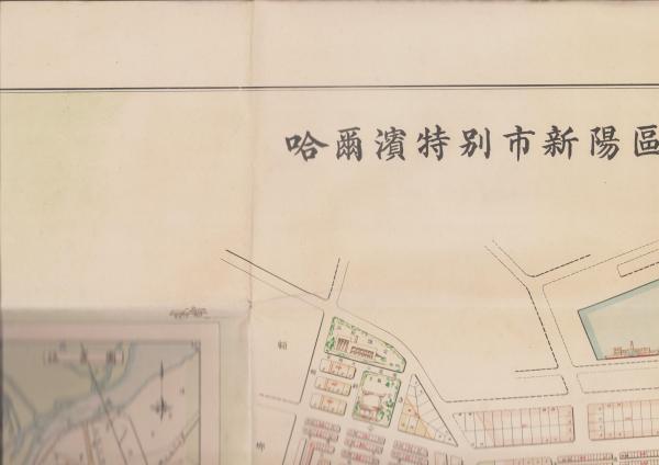
Map of Harbin Special City, Xinyang Ward - Land Sale & Lease Plan, 1936 Manchukuo (1:5000)
Harbin Special City — Xinyang Ward Land Sale & Lease Map
A large single-sheet city-planning map of the Xinyang ward of Harbin Special City, issued in 1936 under Manchukuo — a primary cartographic document of urban administration in 1930s Manchuria.
Historical Context
Under Manchukuo, Harbin grew into one of the principal cities of northern Manchuria, a cosmopolitan railway hub where municipal authorities undertook ambitious programmes of surveying, zoning and land development. Maps of this kind were working instruments of that administration, prepared to govern the sale and leasing of municipal land — and they survive today as vivid records of how the modern city was planned and parcelled.
The Map
Titled as the land sale and lease plan for the Xinyang ward of Harbin Special City, this map was prepared in 1936 (Kangde 3 / Showa 11) by the Land Section, Urban Construction Bureau, Harbin Special City Government. It is a single-sided sheet at a scale of 1:5000, measuring approximately 78 x 108 cm — a generous format that renders individual plots and street layouts in fine detail. As an original period planning document of Manchukuo-era Harbin, it is a scarce survival.
Condition
Fine overall and presenting handsomely. There is slight staining to the verso (reverse side). Fold-lines consistent with a map of this size and age are to be expected. A clean and attractive example; please review all images, which form part of the description.
From a curated holding of East Asian historical maps and documents, offered by an antiquarian dealer specialising in rare Japanese and East Asian materials.
Description & Historical Context
Harbin Special City — Xinyang Ward Land Sale & Lease Map
A large single-sheet city-planning map of the Xinyang ward of Harbin Special City, issued in 1936 under Manchukuo — a primary cartographic document of urban administration in 1930s Manchuria.
Historical Context
Under Manchukuo, Harbin grew into one of the principal cities of northern Manchuria, a cosmopolitan railway hub where municipal authorities undertook ambitious programmes of surveying, zoning and land development. Maps of this kind were working instruments of that administration, prepared to govern the sale and leasing of municipal land — and they survive today as vivid records of how the modern city was planned and parcelled.
The Map
Titled as the land sale and lease plan for the Xinyang ward of Harbin Special City, this map was prepared in 1936 (Kangde 3 / Showa 11) by the Land Section, Urban Construction Bureau, Harbin Special City Government. It is a single-sided sheet at a scale of 1:5000, measuring approximately 78 x 108 cm — a generous format that renders individual plots and street layouts in fine detail. As an original period planning document of Manchukuo-era Harbin, it is a scarce survival.
Condition
Fine overall and presenting handsomely. There is slight staining to the verso (reverse side). Fold-lines consistent with a map of this size and age are to be expected. A clean and attractive example; please review all images, which form part of the description.
From a curated holding of East Asian historical maps and documents, offered by an antiquarian dealer specialising in rare Japanese and East Asian materials.
Collation
| Category | Books |
|---|---|
| Condition | acceptable |
| SKU | N0000004256 |
From the same shelf
Related acquisitions
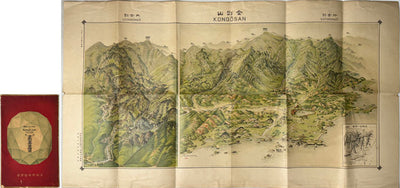
Map of the City of Harbin (China), 1942 - Large Single-Sheet Street Map

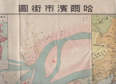
Street Map of Harbin, Scale 1:16,000: Hirooka Mitsuji, 1941
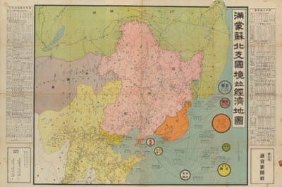
Border and Economic Map of Manchuria, Mongolia, Soviet Territory and North China, Scale 1:4,000,000: With Statistical Summaries, 1936