COLLECTION E
Historical Maps of China · 中国古地图
Original cartographic materials — folded survey maps, atlas plates and annotated prefecture charts — spanning the Qing dynasty through the Republican era, sourced from geography institutes and private collections in Japan.
5 items
Historical Maps of China
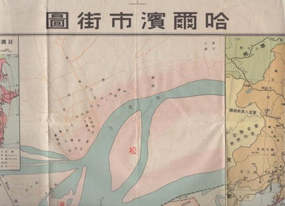
Map of the City of Harbin (China), 1942 - Large Single-Sheet Street Map
¥33,800Detail →

Historical Maps of China
Street Map of Harbin, Scale 1:16,000: Hirooka Mitsuji, 1941
¥46,100Detail →
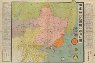
Historical Maps of China
Border and Economic Map of Manchuria, Mongolia, Soviet Territory and North China, Scale 1:4,000,000: With Statistical Summaries, 1936
¥81,200Detail →
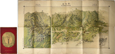
Historical Maps of China
Bird's-Eye View of Kongo-zan (Diamond Mountain), Korea: Pictorial Map, Chosen Governor-General's Temporary Land Survey Bureau, 1923
¥113,100Detail →
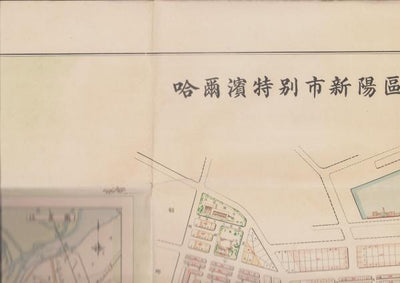
Historical Maps of China
Map of Harbin Special City, Xinyang Ward - Land Sale & Lease Plan, 1936 Manchukuo (1:5000)
¥257,100Detail →